- Winter 2024
- |
- Mapping our links to country, community and creativity
07
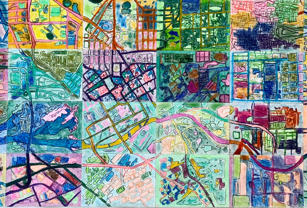
Mapping our links to country, community and creativity
Lucinda Truesdale, Junior School Head of Art

This semester, Year 4 students worked together to create an aerial map of Melbourne, drawing inspiration from Aboriginal artworks that embody deep connections to country and community.
As creative provocations, students explored two significant large-scale collaborative pieces: Yarrkalpa (Hunting Ground) (2013), and Ngurrara: The Great Sandy Desert Canvas (1997). These artworks map country using symbols, colours, and lines to represent culturally significant places and landscapes.
As part of their inquiry into how digital technology impacts our world, students examined how technology has transformed the way we map and perceive geography, contrasting this with traditional methods of mapping the land.
Using captures from Google Maps, students each sketched a section of Melbourne. They infused their drawings with vibrant colours using both oil and soft pastels, drawing direct inspiration from the dynamic and expressive qualities of Indigenous artworks they studied.

It's basically like magic!
– Harvey Huang, Year 4